


What is Hurricane Polo? Why did it attract so much attention?
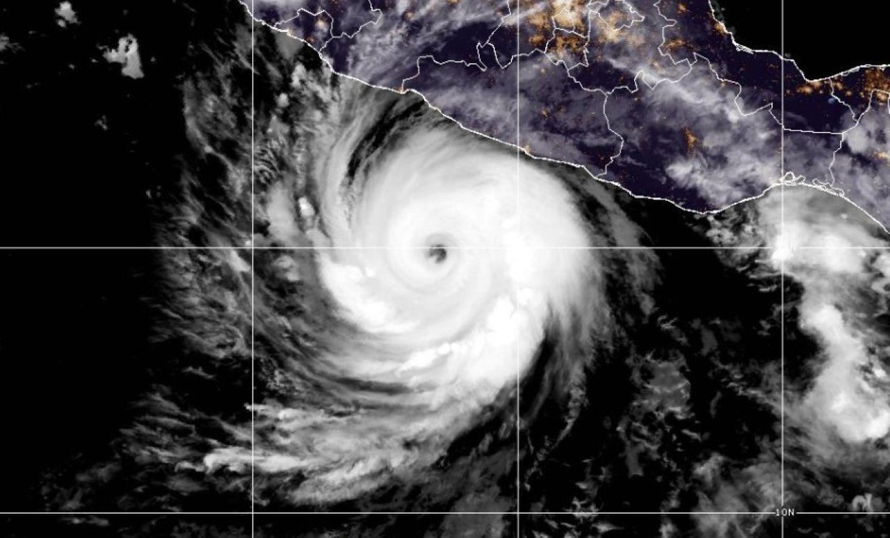
Hurricane Polo made global headlines after rapidly strengthening to Category 5 strength off Mexico's southwestern coast. Its winds increased by about 90 knots in just 24 hours, making the storm's rapid intensification particularly noteworthy.
Hurricane Polo stood out after rapidly intensifying off Mexico's southwestern coast. Polo reached Category 5 strength on Sept. 22, while data from the National Hurricane Center (NHC), part of NOAA, showed that its winds had increased by about 90 knots in the previous 24 hours. The NHC described the pace of the strengthening as "truly remarkable."
Polo's strength was later revealed more clearly through direct measurements by a NOAA Hurricane Hunter aircraft. The aircraft measured maximum sustained winds of about 180 mph (285 km/h) and a central pressure of 892 millibars.
What is Hurricane Polo?
Polo is a tropical cyclone that formed during the 2026 Eastern Pacific hurricane season. Category 5 is the highest category on the Saffir-Simpson Hurricane Wind Scale, with maximum sustained winds of at least 157 mph (252 km/h).
What made Polo stand out was not only that it reached Category 5 strength, but also how quickly it reached that level. According to the NHC's Sept. 22 assessment, Polo's winds increased by about 90 knots in the previous 24 hours.
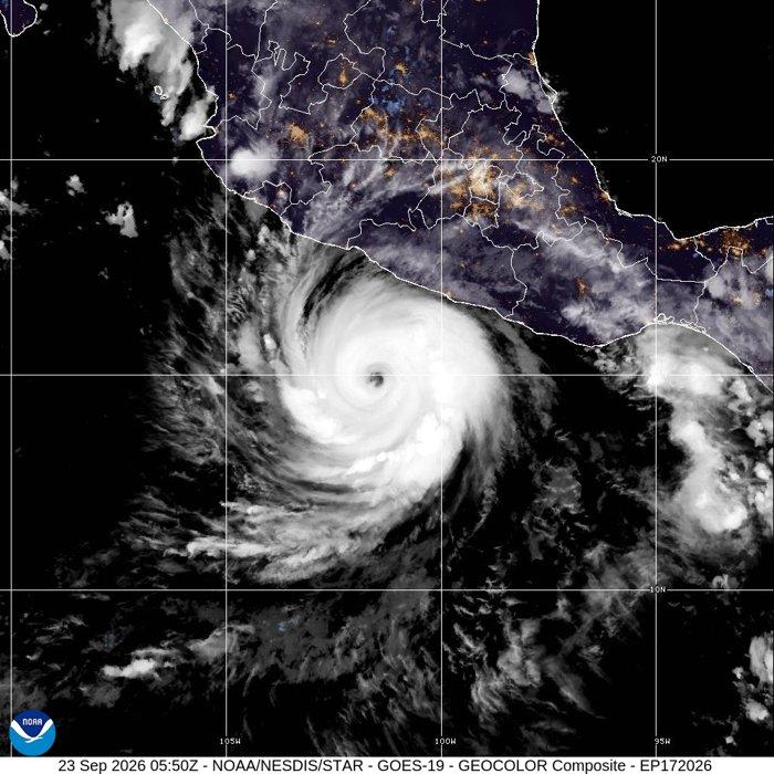
Credit: CIRA/NOAA
How did Polo strengthen so quickly?
According to the NHC, several highly favorable atmospheric and oceanic conditions came together to fuel Polo's rapid intensification.
Sea surface temperatures in the area where the hurricane was located were exceptionally warm. Vertical wind shear was low, while there was also plenty of moisture in the atmosphere. These conditions created an environment favorable for rapid strengthening.
Satellite imagery showed a compact, well-defined eye surrounded by an intense eyewall. The NHC also noted strong upper-level outflow, another factor supporting the storm's rapid intensification.
How strong was Polo?
The highest values measured by the Hurricane Hunter aircraft on Sept. 22 were approximately 180 mph (285 km/h) maximum sustained winds and a central pressure of 892 millibars.
According to the National Hurricane Center, Polo reached a level matched by only a few hurricanes in the Pacific in recent decades. Among them was Hurricane Patricia, which reached 215 mph (346 km/h) in 2015. NOAA's National Hurricane Center has confirmed Patricia's peak intensity at 215 mph.
Polo became the third Category 5 hurricane of the Pacific hurricane season, following Genevieve and Lowell earlier this year.
The hurricane's intensity later fluctuated as its internal structure changed. The NHC reported that Polo was undergoing an eyewall replacement cycle, a process that can cause short-term fluctuations in intensity.
Will Polo reach Mexico?
According to the NHC forecast, Polo is expected to track close to Mexico's southwestern coast. However, the hurricane is not expected to make landfall, with its center forecast to remain offshore.
The Atlantic's longest hurricane-free stretch since 1966
While Polo strengthened in the Pacific, the Atlantic Ocean has seen a very different pattern. As of Sept. 23, no hurricane had formed in the Atlantic during the 2026 hurricane season. The NHC's season summary listed six named storms but zero hurricanes as of 03 UTC on Sept. 23.
The lack of an Atlantic hurricane has extended into the longest stretch without a hurricane since satellite records began in 1966, according to recent reports citing meteorologists.
Although six named storms had formed in the basin by Sept. 23, none had strengthened into a hurricane. The unusual lack of hurricanes has been attributed to a combination of atmospheric and oceanic factors.
- Popular News -

Has Noah's Ark been found? Here's what we know so far

2,500-year-old discovery at ancient city where Alexander the Great's soldiers settled
190-year-old church known for its wall paintings to open to visitors

WhatsApp introduces optional parental controls for teenagers

Is Turkish coffee healthy? A cardiologist explains the benefits and risks of coffee

Catacombs of Kom el Shoqafa: Hidden underground for centuries, discovered by chance